Recreation consists of activities that are pursued for enjoyment. Tourism is the social, cultural, and economic phenomenon of visiting places for pleasure. Outdoor recreation is a significant and growing part of Utah’s economy.[1] Tourists and travelers spent a record $7.8 billion in the Utah economy during 2014, and the tourism industry supported an estimated 137,192 jobs.[2]
Related resource topics for county planning include:
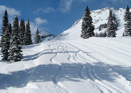
The State Park data, the Park Recreation Points data, the Recreation Opportunities data along with the trail, routes, and ski data can be used to identify areas of the county that have abundant or scarce outdoor recreational opportunities.
The Utah Office of Tourism Industry Site provides research reports regarding economic benefits of tourism and recreation-related spending in Utah. Information by county includes:
- City and county monthly tax distributions
- Utah tourism rankings by county
- Year-over percent change by county
- Tourism profiles by county
Planning resources from the Office of Outdoor Recreation include:
- The Outdoor Recreation Vision document describes Utah’s goals for promoting outdoor recreation. Counties may wish to include similar goals in their resource management plans.
- Statewide 10-Year Plan (forthcoming). Regional summits will be held to engage communities, user groups, and the outdoor industry and provide a platform to give input for the statewide plan.
- The Waypoint Grant Program makes grant monies available with a 50/50 match to communities to build outdoor recreation infrastructure. This was a pilot program in 2015; future grants are dependent on approval of funding from the State Legislature with HB52. Counties can apply for funds and promote awareness of the program.
- Statewide recreation infrastructure map hosted by AGRC (forthcoming). Here is a link to the ArcGIS Online known trails data layer.
- The Utah Search and Rescue Assistance Card (USARA Card) offers expense-paid rescue to individuals (hunters, hikers, other backcountry enthusiasts) for an annual fee. Money raised by the program will support the State’s Search and Rescue Financial Assistance Program. County Search and Rescue teams will receive reimbursement for equipment, training and rentals from the program. Such expenses are often borne by the counties. Once the USARA card is available for purchase, marketing materials will be available to counties for promoting the program.
Planning resources from the Utah Division of State Parks and Recreation include:
- State Park Resource Management Plans
- State Park Visitation Data
- Grants for parks and trails
- The 2014 Utah State Comprehensive Outdoor Recreation Plan (SCORP) provides information about statewide recreation participation, satisfaction, and perceived needs based on a public opinion survey and a survey of municipalities. The SCORP includes information about funding sources for local outdoor recreation facility development including parks, OHV trails, and non-motorized trails.
The Bureau of Land Management has a 5-year (2016-2020) recreation and visitor services strategy called “Connecting with Utah Communities.” The vision of the strategy, ” is to build upon and expand BLM-Utah’s collaboration with local, regional, and national organizations to provide outstanding and sustainable recreation opportunities on Utah’s public lands that produce lasting benefits from the places Utahn’s live, work, and play. Accomplishing this will require BLM-Utah to reposition itself both internally and externally.”[3]
The Wasatch-Cache National Forest’s Revised Forest Plan (2003) recognizes that recreational uses of the forest are varied and increasing. The forestwide goal is to manage for “an array of recreation opportunities and settings” for a variety of users. Further the goal is to “balance growth and expansion of recreation” by managing recreation in a way sustainable within the ecosystem.[4]
The LWCF Projects data shows the location of outdoor recreation projects that have been funded by the Land and Water Conservation Fund.
The following are examples of goals and policies that may be included in a resource management plan to promote and manage recreation and tourism on public lands. These examples come from existing county, state, and federal plans; other examples can be found in the referenced plans and other resources listed below.
- Accessibility Goals
- The County should work with all public land managers and residents to identify appropriate access points to public lands that should be protected or encouraged and develop strategies for providing and maintaining such access points on a long-term basis, while protecting private property rights.[5]
- Additional efforts should be made to provide public land-based recreational opportunities to all individuals regardless of age and/or physical ability.[6]
- Coordination and Partnerships
- Continue to develop relationships with businesses and community groups to support activities at the park.[7]
- Support private land managers, management agencies, and citizen groups in their efforts to coordinate planning and maintenance of recreational opportunities that minimize adverse impacts to natural systems and residential areas.[5]
- Establish public and private partnerships to provide the necessary parks and recreation investments anticipated as development proposals on the vast Kennecott Utah Copper properties are solidified.[8]
- Tourism
- Develop marketing campaigns and materials to attract people to the park from the Wasatch Front, as well as from outside the area, including international visitors.[7]
- The county serves as the coordinating “umbrella” for county recreation and heritage tourism efforts. The county continues to support private, special interest group, and community recreation and tourism efforts.[6]
- Actively participate in regional, state and community public land recreation and tourism promotion and marketing activities. Promote funding and materials coordination among same.[6]
- Economic Considerations, Funding
- Outdoor recreation, tourism and outdoor-related businesses are key pillars of Utah’s growing and diversified economy, and should be promoted along with other important economic sectors.[9]
- Create a funding mechanism to assist in maintaining the recreation facilities and amenities provided in the canyon and that assists in the purchase of available properties for open space purposes. The spirit of this mechanism would be to fund the ongoing recreation operations, including but not limited to trail maintenance, restroom maintenance, recreation sites, education and interpretation of the canyon’s resources.[10]
- Provide the necessary funding for acquisition and construction of new parks, trailheads, recreation facilities, and open space through general tax, bonds, federal, state, and county funding sources, and other means, consistent with the County’s budget needs.[8]
- Interpretation/Education
- Install interpretive signs on trails to foster stewardship and appreciation of canyon history and resources.[10]
- Recognize the value of outdoor activities in the development of children and youth, and through education and hands-on experience, encourage their active participation.[9]
- Improve/expand public awareness and education regarding Tooele County public land recreation opportunities. Outreach efforts may include additional trail/site markers and information displays, local interest articles in newspaper, Deseret Peak Information Center, local hostess program, passport tours, school tours, etc.[6]
- Parks and Facilities
- Support the creation of restroom facilities and parking areas at trailheads, including backcountry trailheads, and popular climbing areas to support the growing recreational uses in Big Cottonwood Canyon.[10]
- Place a priority on locating neighborhood parks in conjunction with school sites and civic facilities.[8]
- Use an existing park facilities assessment and public input to develop community-specific park standards and determine capital needs for future facilities.[11]
- Trails
- Develop multiple-use trails in accordance to the standards and policies identified in the Salt Lake County Parks and Recreation Master Plan.[8]
- Work with the surrounding communities of the region to ensure pedestrian trail and bicycle route connectivity across jurisdictional lines.[8]
- Work with local State Parks to connect park trails with county and city trails.
- Improve recognition of the Bonneville Shoreline Trail.[12]
- User Group Needs and Conflict Management
- Consider new, growing and evolving recreational uses in order to deal with changing impacts.[10]
- Accommodate the needs of equestrian enthusiasts by providing a trail system and connections to the foothill and mountain areas.[8]
- Designate all public land in the Resource Area as either open, closed, or limited for off-road vehicle (OHV) use.[13]
- Utah accommodates a spectrum of activities, while recognizing that not all are compatible in the same location. When conflicts arise, pursue practical, lasting, win-win solutions in an atmosphere of open communication, broad participation, and respect.[9]
Planning resources with information about the economics of recreation and tourism include:
- Kem C. Gardner Policy Institute, University of Utah, Travel & Tourism Reports and Studies.
- Data regarding the economic benefits of Utah State Parks
- A report regarding the Economic Significance of the Great Salt Lake to the State of Utah, includes information regarding economic benefits of recreation. [14]
- An interactive web page from the University of Utah Community Data Project illustrating Utah Tourism Measures 2012-2014 by county.
- Headwaters Economics, Inc.
- The Economic Profile System tool enables anyone to generate county-level reports from multiple data sources (US Census, Bureau of Labor Statistics, Bureau of Economic Analysis) using the most recent data available. Reports related to multiple resource management planning topics can be generated, including economic impacts of tourism.
- The Data Viz website provides recent reports and data summarizations created by Headwaters Economics. An example related to recreation is a report and data regarding benefits of the Land and Water Conservation Fund, 2011-2014.
In 2015, American and foreign visitors made over 7.5 million visits to Utah’s BLM managed federal lands, supported 4,447 Utah jobs, and contributed $460 million in economic activity to the state.[3] The US Forest Service reported over 9 million visitors to the Wasatch-Cache-Uinta National Forest in 2012, which is the most recent data published from the Forest Service National Visitor Use Monitoring (NVUM) program.[15]
- What are the regional economic impacts of recreation and tourism?
- How can recreation opportunities be provided for all user groups (recreation opportunity spectrum) and persons of all abilities.
- What are the interactive effects of recreation land use and other public land uses (energy development, livestock and grazing, mining, wildlife habitat)?
- How will the county’s resource management plan impact recreation activities and visual-resource conditions on public lands, including changes in recreation opportunities, visitation, and facilities?
| Data Name | Data Explanation | Publication Date | Spatial Accuracy | Contact |
|---|---|---|---|---|
| Land Ownership , | Surface Land Ownership; use Admin field to identify administrative agency | Updated Weekly | 1:24,000 | State of Utah School and Institutional Trust Lands Administration (SITLA). GIS Group |
| Ski Areas , | Ski area locations, boundaries, and lifts | 11/16/2015 | 1:24,000 | AGRC |
| USFS Recreation | Roads and Trails, Recreation Sites, Boundary Data and other information | Variable | Variable | United States Forest Service, Uinta-Wasatch-Cache National Forest, Ruth Ann Trudell GIS Database Manager |
| Local Parks , | Non state and non federal parks | Data Download; 1/18/2013 Map Service; 1/18/2013 | 1:24,000 | AGRC (compiled from local sources) |
| Trailheads | Existing and proposed motorized and non-motorized trailheads | 5/27/2015 | 1:24,000 | AGRC |
| Boat ramps | Boat ramps, including State Parks | 1/18/2013 | 1:24,000 | AGRC |
| Golf Courses | Golf courses digitized form Utah Golf Course Association information | 2009 | 1:24,000 | AGRC |
| Recreation Access in Utah | Use to locate properties for various recreational activities. | Variable | Unknown | Utah Division of Wildlife Resources |
| Trails , | Existing and proposed motorized and non-motorized trails | 5/27/2015 | 1:24,000 | AGRC and Utah Office of Outdoor Recreation |
| Land and Water Conservation Fund (LWCF) , | Local parks projects statewide that have received Land and Water Conservation Fund grants | Updated annually | unknown | Utah Division of State Parks |
| Utah Highest Peaks | 113 tallest summits, from 2010 GNIS Placenames | 2010 | 1:24,000 | AGRC derived from USGS GNIS Placenames |
| USFS Roads , | National Forest System Roads Map Service Metadata | Download Data; April 10, 2015 Service; Updated Daily | Variable | United States Forest Service, Uinta-Wasatch-Cache National Forest, Ruth Ann Trudell GIS Database Manager |
References
- Utah Governor’s Council on Balanced Resources. 2013. The State of Utah Outdoor Recreation Vision, January.
- Utah Office of Tourism Industry Website. Accessed January 21, 2016.
- U.S. Bureau of Land Management. 2016. Connecting with Utah Communities: BLM-Utah’s Recreation and Visitor Services Strategy, 2016-2020.
- U.S. Forest Service, Wasatch-Cache National Forest. 2003. Revised Forest Plan Wasatch-Cache National Forest, p.4-22.
- Morgan County. 2010. Moving Forward: Morgan County General Plan. Adopted December 21.
- Tooele County. 2008. Tooele County Access Plan, November (Chapter 19 of the Tooele County General Plan.
- Utah Department of Natural Resources, Division of State Parks and Recreation. 2009. Antelope Island State Park Resource Management Plan.
- Salt Lake County. 2004. Copperton Township General Plan. Salt Lake County Public Works Department, February.
- Utah Governor’s Council on Balanced Resources. 2013. State of Utah Outdoor Recreation Vision, January.
- Salt Lake County. 2013. Big Cottonwood Canyon General Plan Draft. Salt Lake County, Utah, Public Open House Draft, July 17.
- Salt Lake County. 2012. Kearns Township General Plan. Adopted September 11.
- Davis County. 2003. Comprehensive Hillside Master Plan, June.
- US Bureau of Land Management, Salt Lake District. 1988. Proposed Pony Express Resource Management Plan and Final Environmental Impact Statement, September.
- Bioeconomics, Inc. 2012. Economic Significance of the Great Salt Lake to the State of Utah. Report prepared for the Great Salt Lake Advisory Council, January 26.
- U.S. Forest Service, Uinta-Wasatch-Cache NF, USDA Forest Service Region 4. 2016. National Visitor Use Monitoring Data Collected FY 2012.